Dominican Republic 365
Loading
Dominican Republic 365

Hiking Pico Duarte, the Caribbean's highest peak at 3,098 meters, with route options, a day-by-day itinerary, gear list, and guide costs.
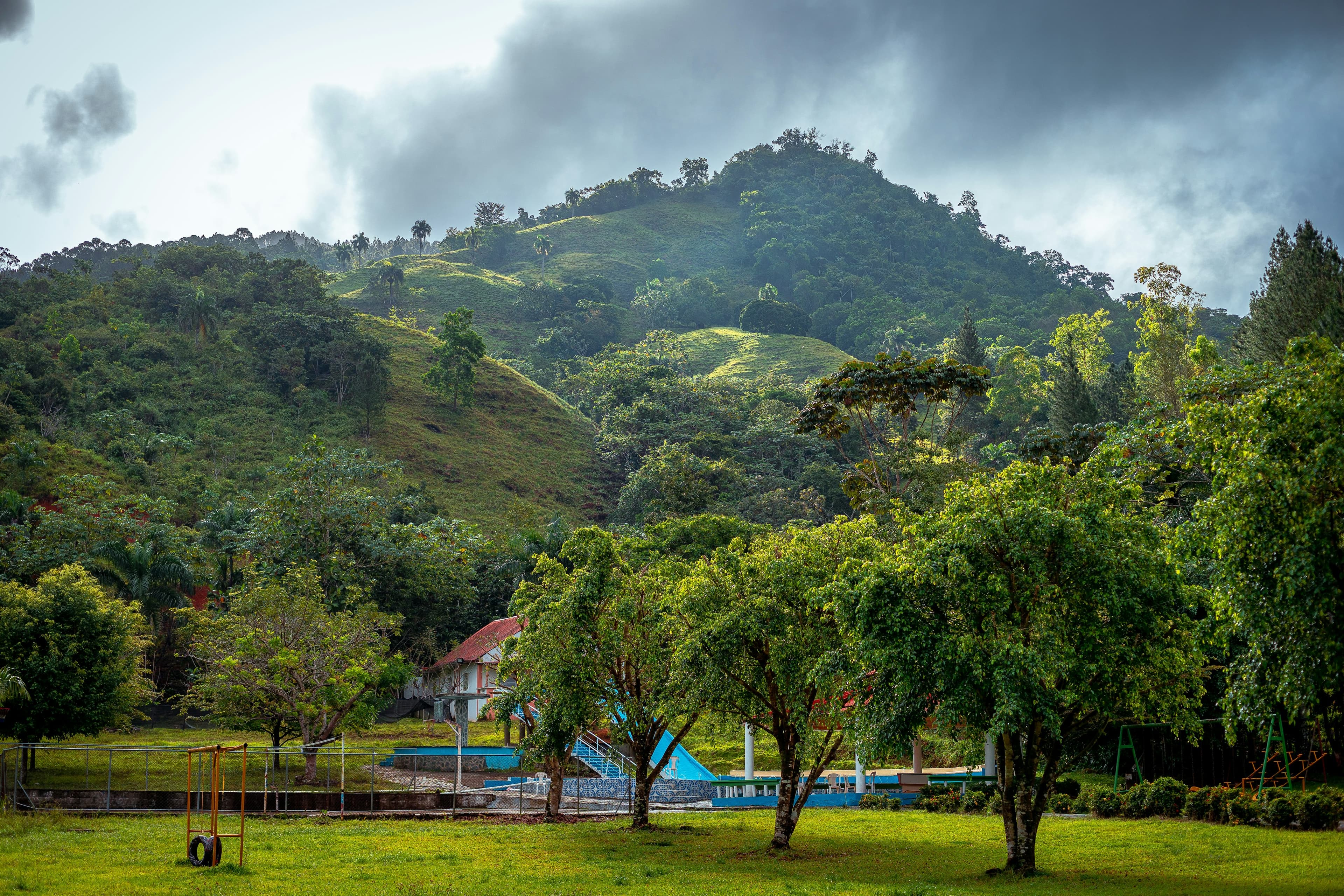
Standing at 3,098 meters (10,164 feet), Pico Duarte is the highest point in the entire Caribbean, higher than any peak in Cuba, Jamaica, Puerto Rico, or any other island. It sits in the Cordillera Central, the mountain spine that runs through the center of the Dominican Republic, surrounded by cloud forests, alpine meadows, and pine-covered ridges that look nothing like the beach postcards most tourists associate with the country.
Climbing Pico Duarte is not a casual day hike. It is a genuine multi-day mountain trek that requires planning, physical preparation, and respect for mountain weather that can drop below freezing. But for anyone with moderate fitness and a sense of adventure, it is one of the most rewarding experiences in the Caribbean, and arguably the best-kept secret in Dominican tourism.
There are several compelling reasons to make this trek, beyond the obvious bragging rights of summiting the Caribbean's highest peak:
This trek connects naturally with other mountain activities near Jarabacoa, including rafting on the Río Yaque del Norte, visiting Salto de Jimenoa waterfall, and exploring the Valle Nuevo National Park.
There are several trails to the summit, but two routes account for 95% of all hikers:
Distance: 23 km one way (46 km round trip). Duration: 2 days / 1 night minimum. Starting elevation: 1,100m. Summit elevation: 3,098m. Elevation gain: approximately 2,000m.
This is the classic route and the one we recommend for most hikers. It starts from the small village of La Ciénaga (about 1 hour from Jarabacoa by car), follows a well-maintained trail through pine forest, passes through the overnight camp at La Compartición (2,450m), and ascends to the summit the next morning. The trail is well-marked, the campsite has basic shelters, and guides know every meter of the path.
Pros: Shortest route, best maintained, most guide availability, the trail is achievable in 2 days for fit hikers.
Cons: The most crowded route (especially on weekends and holidays); the pace is fast, which can be tough for less-fit hikers; the descent on day 2 is hard on the knees.
Distance: 45 km one way. Duration: 3 days / 2 nights. Starting elevation: 900m. Elevation gain: approximately 2,200m.
The Mata Grande route approaches from the west, offering more diverse scenery and a more gradual ascent. It passes through rural communities, dense cloud forest, and the stunning Valle de Bao before joining the La Ciénaga trail near the summit. This route is less crowded, more immersive, and allows more time to acclimatize.
Pros: More scenic, less crowded, gentler pace, passes through beautiful Valle de Bao.
Cons: Requires 3 days minimum, longer total distance, fewer guide options, trail is rougher in places.
The Sabaneta and Las Lagunas routes exist but are rarely used by tourists. They require 3-5 days and are only recommended for experienced trekkers with guides who know these less-maintained trails. Unless you have a specific reason to seek them out, stick with La Ciénaga or Mata Grande.
Most hikers arrive in Jarabacoa the day before the trek. This mountain town at 530m elevation is the staging point for all Pico Duarte hikes. Check into a hotel (Hotel Gran Jimenoa or Rancho Baiguate are popular choices with hiker-friendly services), arrange your guide and mule if not already booked, and do a final gear check. Buy any last-minute supplies, headlamp batteries, snacks, water purification tablets, at the ferretería (hardware store) or mini-market in town.
Have dinner at one of Jarabacoa's restaurants and get to bed early. You will depart at dawn.
Wake at 4:30-5:00 AM. Your guide will arrange transport from Jarabacoa to La Ciénaga, a 1-hour drive on a rough road (4WD recommended). At the park ranger station in La Ciénaga (1,100m), you register, pay the park entrance fee, and meet your mule driver if you have hired one.
The trail begins climbing immediately through a subtropical forest zone, crossing the Río Yaque del Norte on a wooden bridge. The first two hours are moderately steep, you gain about 500m of elevation through dense broadleaf forest. The trail then transitions into Creole pine forest (Pinus occidentalis, a species endemic to Hispaniola), and the gradient eases slightly.
Around the 4-hour mark, you reach an area called Los Tablones, a relatively flat stretch through open pine forest at about 2,000m. This is a good place for a lunch break. The mules usually carry food supplies, so your guide will prepare a simple meal, sandwiches, fruit, and coffee cooked over a small fire.
From Los Tablones, another 1.5-2 hours of climbing brings you to La Compartición camp at 2,450m. Total hiking time: 5-7 hours depending on your pace. The campsite has basic wooden shelters (lean-to structures with tin roofs), a communal fire pit, and a water source. It is rustic but functional. The mule team will have arrived ahead of you with supplies.
Evening at Compartición: Eat dinner (your guide typically prepares rice, beans, chicken or sausage, and coffee), layer up as temperatures drop rapidly after sunset, and get into your sleeping bag early. Nighttime temperatures at 2,450m range from 2-10°C (35-50°F) in the dry season and can drop below freezing in December and January. This is not a figure of speech, it actually freezes on a Caribbean island. A good sleeping bag is not optional.
Wake at 3:00-4:00 AM to begin the summit push. The goal is to reach the top by sunrise. From Compartición, the summit is approximately 3 hours and 650m of elevation gain. The trail climbs through thinning pine forest into the Valle de Lilás, a high-altitude meadow dotted with Lilís plants (not actual lilies but a local alpine shrub). The air is noticeably thinner here, and the landscape is stark and beautiful.
The final approach to the summit follows a ridge with panoramic views on both sides. On a clear morning, you can see both the Caribbean Sea to the south and the Atlantic Ocean to the north. The summit itself is marked with a bust of Juan Pablo Duarte (the Dominican founding father for whom the peak is named) and a Dominican flag. The temperature at the summit is typically 0-5°C (32-41°F) at dawn, bring every warm layer you have.
Spend 20-40 minutes at the summit for photos and to absorb the view, then begin the descent. You will return to Compartición in 1.5-2 hours, eat a quick breakfast, pack up, and hike back down to La Ciénaga, another 4-5 hours. The descent is faster but harder on the knees and ankles. Trekking poles are invaluable here.
Arrive at La Ciénaga by early-to-mid afternoon, where your transport back to Jarabacoa will be waiting. Most hikers arrive back in town exhausted, satisfied, and ravenously hungry. Celebrate with a hearty meal and a cold Presidente.
Pico Duarte is not a technical climb, there is no scrambling, ropes, or exposed ridges. It is, however, a demanding endurance hike. Here is what you need to know:
Packing for Pico Duarte requires a mindset shift: you are packing for cold mountain camping, not a Caribbean vacation. Nighttime temperatures can drop to -3°C (27°F) in peak dry season. The biggest mistake hikers make is underestimating how cold it gets.
A guide is mandatory for all Pico Duarte hikes, this is enforced at the La Ciénaga ranger station. You cannot enter the park without a registered guide. This is not a bureaucratic nuisance; guides know the trail, manage the logistics, cook meals, and have emergency training.
Guides are typically arranged through one of three channels:
Tip your guide. A standard tip is RD$500-1,000 (US$8-17) per day, more if the service is exceptional. These are hardworking local men who carry heavy packs and cook in difficult conditions.
Mules carry supplies (food, water, sleeping bags, firewood) between La Ciénaga and Compartición. You can also ride a mule on portions of the trail if you are struggling physically, though most hikers walk the entire route.
Mule rental: RD$1,500-2,500 (US$25-42) per mule for the 2-day trip. One mule can carry gear for 2-3 hikers. The mule driver (separate from your guide) leads the animal and manages loading/unloading. Tip the mule driver RD$500 (US$8) at the end of the trip.
La Compartición is the primary overnight camp, located at 2,450m on a ridge with views in every direction. The "camp" consists of several wooden lean-to shelters with tin roofs and raised wooden platforms for sleeping. There are no walls, you are essentially sleeping under a roof with open sides. This means wind and cold penetrate freely, which is why a warm sleeping bag is essential.
A communal fire pit serves as the social center of camp, and your guide will build a fire for cooking and warmth. The fire is also the only source of heat. Gather around it, share stories with other hikers, and enjoy the star-filled sky, at 2,450m with zero light pollution, the Milky Way is staggeringly vivid.
There are basic pit latrines near the camp. No showers. The water source is a small stream 5 minutes downhill from camp, treat or filter before drinking.
Jarabacoa is the gateway town. From Santo Domingo, take Caribe Tours bus to Jarabacoa (RD$400/US$6.70, 2 hours) or drive (2 hours via Autopista Duarte to La Vega, then 30 minutes south to Jarabacoa). From Santiago, it is 1.5 hours by car or bus.
From Jarabacoa to La Ciénaga: approximately 1 hour by 4WD vehicle on a rough mountain road. Your guide or tour operator will arrange this transport. A private 4WD taxi costs RD$2,500-4,000 (US$42-67) each way. The road is unpaved for the last 20 minutes and can be muddy in wet season, a sedan will not make it.
Total cost for a standard 2-day La Ciénaga route hike, per person (based on a group of 2-4):
Total per person: RD$6,000-15,000 (US$100-250), depending on group size. Larger groups pay less per person because guide, mule, and transport costs are shared. A complete package through Rancho Baiguate (everything included) runs US$150-250/person with a minimum of 2 people.
The ideal window is December to March: the dry season in the mountains. Skies are clearest, trails are driest, and the chances of a cloud-free sunrise at the summit are highest. January and February are the coldest months (summit temperatures of -3 to 5°C), but the clear views are worth bundling up.
The wet season (May-November) brings afternoon thunderstorms, muddy trails, and reduced visibility. Hiking is still possible but less enjoyable, you may summit in thick cloud and see nothing. The trail can become slippery and creek crossings may be deeper than usual.
Avoid Dominican holiday weekends (Semana Santa/Easter week, Christmas-New Year, Independence Day in late February). The trail and Compartición camp can be overcrowded with Dominican groups, and the atmosphere shifts from wilderness trek to busy campsite. Weekdays in January-March are the sweet spot.
If you hike regularly, you are probably fine. If your most strenuous exercise is walking to the car, start training 4-6 weeks before your trip:
The Cordillera Central is a biodiversity hotspot. On the trail, look for:
Photography tips: bring a wide-angle lens for summit panoramas and a fast lens for dim forest conditions. The sunrise from the summit is best captured with a tripod (lightweight travel tripod adds 500g to your pack but is worth it). Smartphone cameras work fine for most shots, the light quality at altitude is exceptional.
The standard La Ciénaga route takes 2 days and 1 night: 5-7 hours of hiking on Day 1 to reach the Compartición camp, then 3 hours to the summit and 5-6 hours back down to La Ciénaga on Day 2. Total active hiking time is 13-16 hours over two days. The Mata Grande route takes 3 days and 2 nights. Some extremely fit hikers and trail runners complete the La Ciénaga route in a single long day (12-16 hours), but this is not recommended for most people.
Yes, a guide is legally required. You will be turned away at the La Ciénaga ranger station without one. Beyond the legal requirement, a guide is genuinely useful: they manage logistics, cook meals, know the trail intimately, carry emergency supplies, and can assist if you have altitude issues or injuries. Guides cost RD$3,000-5,000 (US$50-83) for the 2-day trip, split among your group.
The three most critical items: a sleeping bag rated to 0°C (32°F), warm clothing layers (fleece, thermal base layer, hat, gloves), and sturdy hiking boots. People consistently underestimate how cold it gets, this is a mountain above 3,000m, and nighttime temperatures drop below freezing in the dry season. Also essential: headlamp, rain jacket, 2-3 liters of water capacity, trekking poles, and sunscreen. See our detailed gear list above.
Not inherently dangerous, but it demands respect. The main risks are hypothermia from inadequate clothing/sleeping gear, dehydration, and knee/ankle injuries on the descent. There is no technical climbing or exposure to falls. With a guide, proper gear, and reasonable fitness, the risk is low. The biggest "danger" is going underprepared for the cold and having a miserable, sleepless night at Compartición because you brought a beach towel instead of a sleeping bag.
This guide covers Jarabacoa. Explore more about this destination.
View DestinationOur team includes contributors who live in the Dominican Republic year-round and travel the island extensively, from Santo Domingo to remote southwest villages.